4mm Wolsey's Creek

Yorkshire Dave

Western Thunderer
Looking at the position and design of the retaining wall it was probably there to mitigate erosion of the narrow spit by the fast moving water around the bend in the narrow Walberswick Cut. Otherwise it would have cut through and isolated the footbridge at the end of the spit.

The tidal range here is 2.5m and being very close to the coast there will be quite a volume of water flowing with the rising and falling tides.
 
Last edited:

Yorkshire Dave

Western Thunderer
When you look at the NLS OS 1892-1914 25 inch series and change the overlay transaparency in respect of the underlying satellite imagery you can see how 100 years+ coastal erosion and intervention has changed the area. I've annotated two NLS extracts to show this.

NSL Walberswick.jpg

And a zoomed out version of the coastline. Red being 1892-1914 and yellow from today's satellite imagery.

NSL Walberswick wide.jpg
 

PaulR

Western Thunderer
Thanks for that bit of research Dave, it's very informative - and fascinating. Apart from the erosion along the coast it's interesting to see how the deposit has built up on the south side of the estuary and effectively moved that part northwards. I can't wait to get back there and do some more research, and it's tempting to chuck the tent in the car and just set off. It'll have to wait for a bit though as family commitments make it impossible right now - September perhaps.

I'm assuming that the river will remain much more stable from now on with it being so well used; there are retaining walls on a lot of the southern bank now but it still retains that slightly shambolic atmosphere.


Southwold 1.JPG


Southwold 2.JPG


Southwold 3.JPG
 

AJC

Western Thunderer
I'm assuming that the river will remain much more stable from now on with it being so well used; there are retaining walls on a lot of the southern bank now but it still retains that slightly shambolic atmosphere.

I agree with the shambolic (and it's attractive, in the way that watery contexts are), but this patch of coast is mobile, places come and go.

The community of Dunwich took huge efforts to manage that and keep their port open (the same is true of most of the East Coast ports), but it failed. The archaeology is really interesting and reveals a surprising amount about the lost town: 
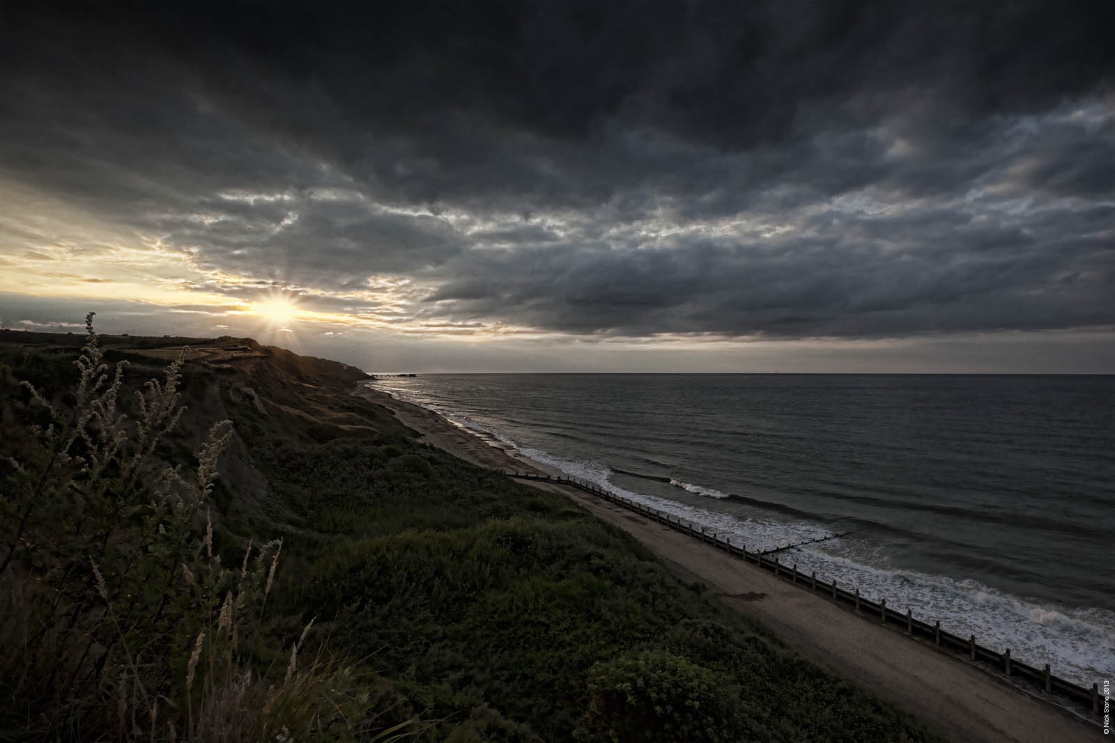
. Shipden - Cromer's predecessor, is also out to sea (per my online acquaintance, Nick's excellent blog): Cley, Blakeney and Thornham suffered the opposite fate, silting. Why yes, I have been imagining what the M&GNJR might have done with some of those...

Adam
 
Last edited:

Herb Garden

Western Thunderer
Thanks for that bit of research Dave, it's very informative - and fascinating. Apart from the erosion along the coast it's interesting to see how the deposit has built up on the south side of the estuary and effectively moved that part northwards. I can't wait to get back there and do some more research, and it's tempting to chuck the tent in the car and just set off. It'll have to wait for a bit though as family commitments make it impossible right now - September perhaps.

I'm assuming that the river will remain much more stable from now on with it being so well used; there are retaining walls on a lot of the southern bank now but it still retains that slightly shambolic atmosphere.


View attachment 219973


View attachment 219974


View attachment 219975
That coach looks like GER type 3b pre 1885 stock... Most likely a 3rd due to the close nature of the compartments... Would need a full side on view to work out the diagram but would either be a 402 (4w five compartment 3rd) or 403 (6w six compartment 3rd)

Sorry that is way to much useless information! It's a grounded coach body
 
Top